The Gibb River Road and the Kimberley
Friday 27th June - Day 1 - Darwin to Katherine
I was off to travel by 4WD down the Gibb River Road in order to explore and photograph the Kimberley region of Western Australia. We had hoped to get away by 2pm but Kat and Jaysin had a little lover’s tiff, so we didn't end up leaving til after 4pm. The trip was fairly unadventurous and we arrived in Katherine around 7pm. We grabbed some dinner at the Katherine Club and then headed over to the Shady Lane Tourist Park on the road out to Katherine Gorge.
Saturday 28th June - Day 2 - Race Day in Katherine
We had entered ourselves (and some friends) in a team-relay endurance event called the Katherine Ultra Challenge (http://www.katherine-ultra-challenge.com/). This consists of 6 legs: a 3km swim, 10km cross country run (My leg), 25km mountain bike ride, 8km road run, 17km canoe, and 37km road bike. At first I thought the Cross Country wasn't too bad, but then half way through the hard packed scrubby bush changed into a soft-sand river bed and the running got seriously hard work. I had set myself a target of 1 hour, and was a little disappointed to finish in 1:00:51, missing out by just 51 seconds. However there were a few sections were the track wasn't well marked, and I had to turn around and retrace my steps four times, so that cost me at least that much. Still it would have been nice though...


As well as the six people in my team the group we were with had entered 2 other teams. My team was mixed and we finished 26th out of 42 teams. We also had an all men’s team that came 32nd, and all women’s team that came 40th.

After the race all 3 teams headed back to our campground and had a BBQ and quite a few beers before calling it a night.
Sunday 29th June - Day 3 - Katherine to El Questro Wilderness Park
(East Kimberley, Western Australia)
We fires up the BBQ again and had a huge breakfast before heading off mid-morning. Our first setback came at the WA border. It turns out that WA has a strict fruit and veg quarantine, and the big bags of apples, potatoes and onions we had bought for the trip were confiscated.
Shortly after we crossed the border we began to see the odd Boab tree. If you have never seen these before they are an amazing tree. Most have few if any leaves on them, and I've seen them described as a "tree that was planted upside down". They have absolutely massive trunks, are drought and fire resistant and live for over 1000 years. At one point we saw two massive ones side by side not far from the road so we pulled over to take some photos. I deliberately put the 4WD in the picture to give you an idea of the scale.

 We got another shock at Kununurra as sunset in Darwin is about 6:30pm but the sunset here was at 5pm. We briefly considered stopping there but decided to press on to El Questro. This meant that we did the first 50kms of the Gibb River Road in the dark, along with the 20km drive into the station. The total blindness caused by the dust clouds when you passed another vehicle came as a bit of a rude shock, but we made it through unscathed and reached El Questro.
There are 2 ways of camping at El Questro - a large communal campground just by the Station Township, or individual campsites scattered along the river. Kat and Jaysin were tempted to just take the easy route and settle in the main campground, but I held out for the river sites and when we looked around the next day in the daylight they were very glad I had.


Monday 30th June - Day 4 - Exploring El Questro
We started off the next morning with a challenging 4WD track up the side Saddleback Ridge. This ridge has a lookout platform that offers a 360o view out over the Wilderness Park. The info sheet says "This 7km round trip takes about 40 minutes. The track is very steep and narrow with lose stones and hairpin bends. Drive slowly and use low range 4WD. Experienced 4x4 drivers only!" 

We made it up the track with no problems, but when we went to come back down we discovered that a sharp stone had managed to squeeze through the gap in the tread pattern and puncture the tire. We tried to change the tire up on the ridge top, but discovered that the shop had tightened the wheel nuts so tightly with their machine that we could not remove them by hand. My father had specifically warned about that possibility, and Jaysin and I had said we were going to check that before we left but somehow it never happened. Oops. Fortunately I had bought a little air compressor that runs off your car battery so we filled the tire to it's maximum pressure and then limped our way back down the ridge and into the station township.

Fortunately the station maintains a full workshop and they were able to loosen the wheel nuts for us. We changed tires and left the flat with them to fit a new tube while we went and explored more of the area. We had intended to go for a swim at a place called Zeebeedee Springs [any other Anne McCaffrey fans recognise that reference ;-) ] but unfortunately it is only open until midday and we were too late. We went to El Questro gorge instead. It was too late in the day to try the full 7km return walk but we did walk in to the swimming hole called halfway where we enjoyed a cool but pleasant swim before heading back to the township to pick up the tire.


Tuesday 1st July - Day 5 - El Questro to Drysdale River Station
We got up early and met our guide at the stables at 6.30am before a 2hr horse ride around the station. I had done a fair bit of riding in my early teens at the H Ranch near Milton in NSW, but had not been on a horse in over 20 years. I was given a beautiful mare called Trannie [ I chose to believe it was short for Transylvania and not anything else ;-) ] and had a terrific time. My trotting was atrocious, but I was fine on the canter, and even managed a gallop across the paddock leading back to the stables.


We returned to our campsite and packed up the gear before setting off. After the flat the previous day we seriously considered driving back to Kununurra to buy a second spare wheel. However we decided against it, a decision we were questioning when we got our second flat of the trip just 150kms up the road. To make matters worse it was not a simple puncture but a 10cm cut meaning the tire had to be replaced completely. And to add insult to injury it was not one of the old tires that went but the brand spanking new spare that had only the 150kms we had done that morning on it.
 Our largest water crossing of the trip came just before lunch. We stopped for some photos and I got some nice ones of some sort of crane or ibis taking off.

The time lost to the flat and the fact that we slowed right down to try and avoid another puncture meant that we couldn't reach the Mitchell Plateau campsite that night but instead stopped along the Kalumburu Road at Drysdale River Station. Due to the frequency of tire damage in this part of the world Drysdale also do tire repairs, and in fact had a range of tires for sale that would match some small tire stores. We camped at the station overnight, and they replaced the tire for us in about 15 minutes the next morning, meaning that we were under way fairly early.
The guy at the station suggested we let some of the air out of our tires, and there must have been something to that as once we did we didn't have another flat for the rest of the trip.
Wednesday 2nd July - Day 6 - Drysdale River Station to Mitchell Plateau
The road from Drysdale up to the Mitchell turnoff is actually in very good condition apart from the bone rattling corrugations that shake your car to pieces around you if you let your speed slip below about 70km/h. However the secondary road from the turnoff up to the campsite is not as good, and provided some challenges. Still we made it through unscathed.
It is quite a hike down to the Mitchell Falls, so we set up camp, then Jysin and I drove about 15kms back out of the national park to the area where you are allowed to collect firewood. After an hour or so sweaty work chopping through a fallen redwood tree we headed back and enjoyed a campfire before an early night, ready to tackle the walk the next morning.
Thursday 3rd July = Day 7 - Mitchell Falls
The hike in is challenging but not backbreaking, and we made it down to the falls in about two and a half hours, although it could have been much quicker if Jaysin and I weren't both keen photographers and so stopping constantly to take photos. There are two smaller falls, Little Merten Falls and Big Merten Falls, before you reach the main Mitchell Falls.


There is an amazing section of Aboriginal art underneath Little Merten falls, some of which dates back 17,000 years.


Next up is Big Merten, which did not have much water at this time of year but which offered a spectacular view along a gorge.


Last but certainly not least is Mitchell Falls itself.


We spent an hour or so taking photos, and then another few hours swimming and lying around to allow the heat of the day to pass, before walking back up in the late afternoon.
Another campfire and we were off to bed, ready for our next adventure.
Friday 4th July - Day 8 - Mitchell Plateau to Mt Barnett Station
The drive back down was mostly uneventful but we did have a brief scare when we had the speed up to get over the corrugations and found ourselves in a sand drift coming round a bend. I fought to get the car back under control as we fishtailed but I had to keep turning back into the slide to avoid tipping over. We looked like we were heading for the tress and I made a decision to head for one about the thickness of your wrist as I definitely didn't want to hit the monster after it but with nothing left to lose I braked hard at the last moment and managed to pull the car up about a metre short of the tree. Shaken but not stirred we gathered our thoughts and set off again.
Somewhere on this leg I ended up up with some more photos of cows. Jaysin and Kat seemed to be obsessed with cows. We stopped at least once on every leg to take photos of some. I have to say having lived in the middle of some of the worlds biggest cattle stations for over a decade by about cow 3 I was over it. However I was just as obsessive with taking photos of any new bird we ran across so I guess turn about is fair play.


Mitchell Plateau to Bell Gorge was just a little too far to try and tackle in one hit so we stopped at Mt Barnett Station for the night. Although there is a gorge there to explore we only picked it because it was a convenient spot, and our timeline was tight enough that we decided not to try and explore that one but to continue on to Bell Gorge.
Saturday 5th July - Day 9 = Mt Barnett Station to Bell Gorge
We managed to get packed up and on our way by 8:20am and so made it to Bell Gorge by late morning. There had been a bushfire through and the campsites we had hoped to use were closed to the public. We drove on down to the falls anyway, and had only gone about 200m when we came across a large Mitchell's Water Monitor (an amphibious goanna) strolling across the road. Jaysin and I spread out so the monitor was between us, which allowed us to approach for some great closeups without giving the monitor an opportunity to run away. If you are going to try this yourself remember that when they are scared goannas run up the nearest tree, so the last thing you want to do is freeze in terror and make like a tree.


We continued on to the parking area and walked down to the falls where we took some great photos before another afternoon of swimming and lying around.


Sunday 6th July - Day 10 - Bell Gorge to Windjana Gorge
An even earlier start than yesterday saw as arrive at Windjana around noon. We found a terrific site right at the end of the campground facing the range and set up the campsite before heading into the Gorge. The range at Windjana is the remains of a coral reef from the Devonian period, and there are several fossils to be seen. It is an amazing mix of black and red and looks spectacular in the reddish light approaching sunset.

 Windjana Gorge has the highest density of freshwater crocodiles anywhere in the world, and it was not long before we saw a couple out sunning themselves on the riverbank. A bit further on we were able to walk right up to them, and spent 10 minutes photographing them from as close as 1 metre away. I even reached out and felt the tail of one much to my friends amazement.


 I was taking a photo of a Kookaburra I had spotted when I heard a rustling noise in the grass moving diwn the hill side. We had been hoping to see a snake since the trip began and finally this was it. I briefly considered picking it up as the snakes at Windjana are mostly children’s, olive and carpet pythons, all harmless, but it looked just a little bit too much like a brown snake for me to take the chance. *Grin*

 We continnued right round to the end of the Gorge, but we had left it a little late and ended up walking back first in fading liht and then in darkness. Fortunately the sky was clear and the moon, whildt only a quarter moon, was quite bright.
Monday 7th July - Day 11 - Windjana Gorge to Broome
Jaysin had arranged a business meeting at 1:30pm in Broome so we hit the road before 7:30am. This proved to be lucky as there was quite a bit of roadwork going on and the trip took much longer than we had expected.
We arrived at 11:30 but were tole we couldn't check in until 12:30 so we went and had a coffee in a cafe then went back to check in and have our first hot shower in over a week. Kat and I did our own thing whilst Jaysin had his meeting then we all caught up about 5pm and headed out to cable beach to watch the sunset and see the camels. We shared a bottle of wine with one of the girls from the Katherine Ultra Challenge who had travelled to Broome along the bitumen road whilst we were doing the Gibb. It really is a small world - Tina is a teacher at Darwin High School and the friend she was travelling with is a teacher in Tennant Creek, which is where I started teaching.


Tuesday 8th July - Day 12 - Explore Broome
Lazy day wandering around Broome, shopping for the return leg, washing clothes and relaxing. Drove to Cable Beach for another sunset and more camels.


Wednesday 9th July - Day 13
On the road about 9am, drove the 150kms back to the Fitzroy Crossing turnoff and then set off across the Northern Highway. It might be picturesque to people not used to this sort of country but it's practically indistinguishable from outback NT so for us it was just a matter of putting as many kilometres behind us as possible as we headed for the Kimberley. The only real highlight was all the wedge-tailed eagles circling around the petrol station in Fitzroy Crossing. We arrived at a roadside campsite called Leicester's Rest just after sunset and set up camp quickly before an early night.
Thursday 10th July - Day 14
Bungle Bungles! We set off fairly early and found the turnoff into the Bungle Bungles just a few kms up the road from the campsite. 53kms of rough and windy dirt track later we made the visitors centre, and then it was another 25kms of the same to the actual domes, but boy was it worth it! There is some terrific scenery on the drive in, but nothing to compare with the sight waiting for you when you arrive. This was definitely one of the highlights for me.


Since I drove in Jaysin drove out so that I could check out the scenery. We stopped briefly at Warmun Roadhouse to clean the windscreen and pump the tires back up now that we were staying on the bitumen and then continued on our way. We got to Kununurra about an hour after sunset and managed to get the last campsite available in the local van park.
Friday 11th July - Day 15
I was up at 10 past 5 in the morning to try and get some shots of all the birds I could hear, but when I got out there it was still too dark for photos. I wandered over to the trees without the camera just to see what was about and there not 3 metres away was a blue winged kookaburra. But of course by the time I went back for the camera he was long gone. :-(
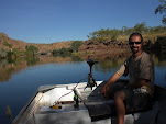
We hit the road about 8:30 and headed off to Lake Argyle. The drive in is gorgeous with amazing mountains and scenery on all sides. The lake itself is magnificent and absolutely huge - 9 times the size of Sydney Harbour.


We spent a few hours checking out the various lookouts and then headed off towards the NT and home. We thought we would camp somewhere between Timber Creek and Katherine but we made such good time that we arrived in Katherine right on sunset. Then after some dinner we decided we were close enough to home that we might as well as keep going. So tired, stiff and dirty we struggled back in to Darwin about 10:15 last night.
posted by Jay @ 10:48 AM
0 comments
![]()
